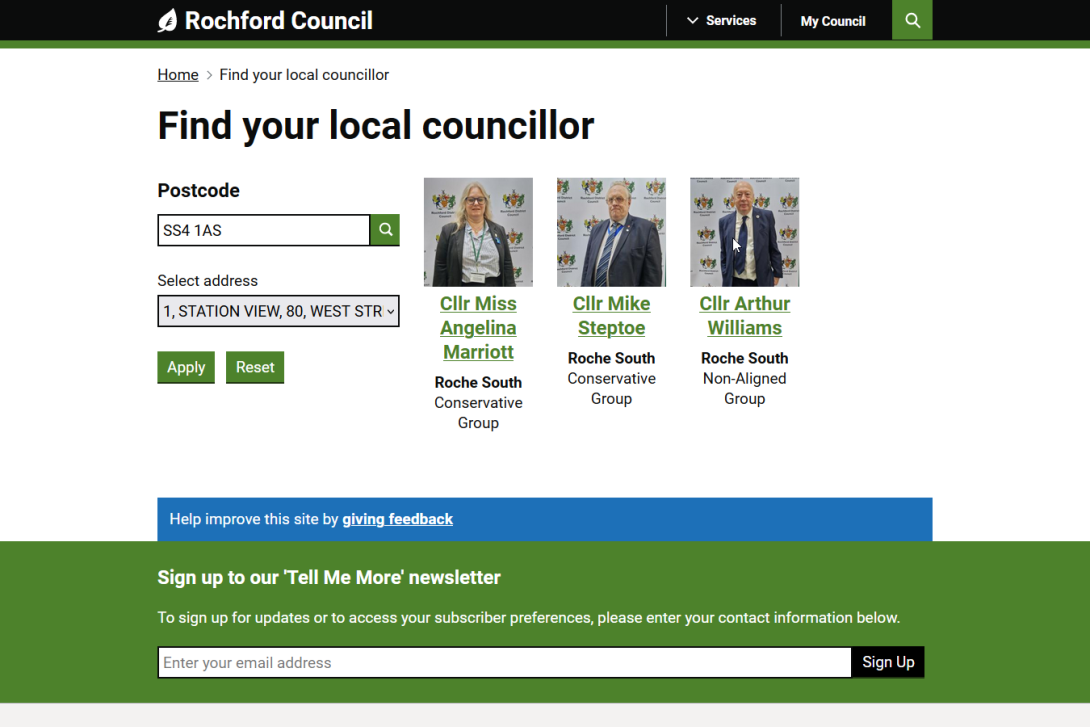
"Find your local councillor" functionality is now live on Rochford.gov.uk, allowing citizens to easily find their councillors by entering their postcode and picking their property from an autopopulated list.
As a recap, this works by:
- Uploading a data set in the form of a CSV file into the Platform's admin system. This follows a simple template format.
- Integration with the Ordnance Survey's APIs to:
- Retrieve a list of properties for a user inputted postcode.
- Obtain the "Unique Property Reference Number" for the user selected property.
- Find the ward the property is in.
- Returning the Councillors that match the resulting ward.
You can test it for yourself by browsing to https://www.rochford.gov.uk/your-local-councillor, entering the Rochford postcode "SS4 1AS", picking one of the resulting properties and clicking "Apply".
Most public sector organisations can use the Ordnance Survey's APIs for free under the "Public Sector Geospatial Agreement" (see https://www.ordnancesurvey.co.uk/customers/public-sector/public-sector-…).
This functionality is in the core of Council Platform, so is available to all subscribers to use at no extra cost.